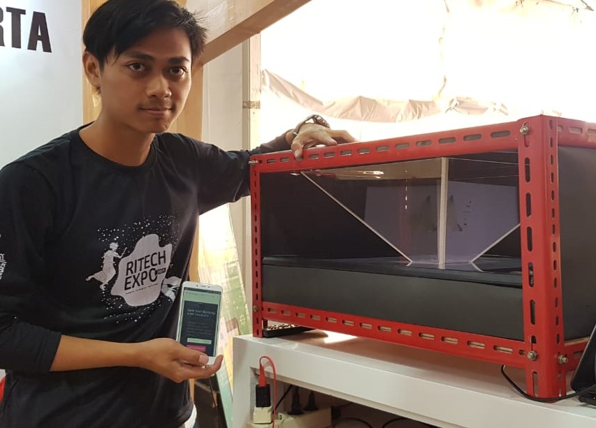
DENPASAR - UPN "Veteran" Yogyakarta students (UPNVY) created a disaster special information application called Geobuild. Through this application, the public can obtain information about disasters that occur in regions in Indonesia.
"Currently, it is still in the development stage. We plan to make this application downloadable through the Playstore and Appstore," said Syaiful Adala, one of Geobuild's innovators, Tuesday (8/27).
This student of UPNVY Informatics Study Program 2016 explained the application he made with his two colleagues Nur Ezha Vidawati (Industrial Engineering), and Nugroho Anjar Pratama (Geological Engineering) is a projected application of building construction with geological disaster parameters.
The initial idea of ??designing this application originated from the concern of many disasters that hit Indonesia at the end of 2018.
"There were lots of casualties and building damage as the impact of the disaster. So, we came up with an idea to minimize this impact by presenting information on the disaster in level of an area", said Syaiful.
Syaiful and the team designed Geobuild for four months under the guidance of the Informatics lecturer, Simon Pulung Nugroho, M.Sd.
"The process of making Geobuild was done starting from the tool design, coding and mapping, tool making, integration to testing and improvement’, he said.
This seventh semester student explained that Geobuild disaster data was entirely taken from the National Disaster Management Agency (BNPB) and the Meteorology, Climatology and Geophysics Agency (BMKG), so that he and his team could present the building construction engineering to anticipate the potential disasters in the area.
"For making maps of disaster areas, we determine data of rainfall parameters, soil type, elevation, land use, etc. We extract data from BMKG, PVMBG and tanahairku website. Still, the data is only in the Special Region of Yogyakarta right now”, he said.
Not only disaster maps, this application can also display the construction in the form of holograms.
"Hopefully, the public can find out what kind of building is suitable in an area with this application, so that it can determine the construction design."
The future development of Geobuild, said Syaiful, is to add information on the disaster vulnerability in other areas and to include additional information on the disaster vulnerability such as landslides, etc.
This Geobuild disaster application was exhibited at the UPNVY Stand at the Ritech Expo 2019 event which is taking place on August 25-28, 2019 at the Puputan Margarana Field, Renon, Denpasar, Bali.
Ritech Expo 2019 is an annual event which is a venue for the appearance of research and innovation by the nation's children. During the Ritech Expo, the public can take part in all the events free of charge and will be presented with interesting innovation products from universities, Non-Ministry Government Institutions (LPNK) under the coordination of the Ministry of Research, Technology and Higher Education, Main Unit of Ministry of Research, Technology and Research, Research and Development Agency (Balitbang) Ministry or State Institutions (K / L), Regional Balitbang, BUMN, Industry, Community Science and Technology Center (PUI) community and associations, as well as foreign partners.
In addition, this year's Ritech Expo also holds seminars, product innovation demonstrations, science demonstrations, business meetings, open theaters that present live music as well as film screenings and contests with attractive prizes. (wwj / PR)
Jl. SWK 104 (Lingkar Utara), Condongcatur, Yogyakarta 55283 (Kampus Pusat)
Jl. Babarsari 2 Yogyakarta 55281(Kampus Unit II) | Telp. +62 274 486733


